Wildfire Info

Wildfire Info for PC and Mac

Published by David Gross on 2024-02-14

  • Compatibility: Available on Windows 11, Windows 10, Windows 7 & MacOS 10, 11, 12.4
  • Category: Weather
  • Licence: Free
  • Software version: 4.7.1
  • File size: 7.04 MB


Download ⇩


Wildfire Info Overview

What is Wildfire Info? The app allows users to browse current wildfire and prescribed burn activity worldwide. It provides active wildfire perimeter data, thermal hotspot maps, recent wildfire news, official incident webpages, traffic incidents related to fires, hyper-local weather conditions, wildfire situation reports, satellite animations, hourly air quality data maps, and a map measurement tool. Premium users can view true color images and lookup driving routes to any fire or hotspot. The app also features wildfire-related US government Twitter accounts and a user-submitted fire map. Information is sourced from various organizations, and the app is not affiliated with any government agency. Terms of Use apply.


Screenshots

→   →   →   →   →  


Wildfire Info Features and Description

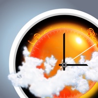
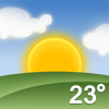
1. Lookup current hyper-local weather conditions, including temperature, wind and gust conditions, and local forecasts anywhere in the USA, Canada, or Australia using map quick lookup or, for USA, search: Detailed NWS Forecast, Hourly Forecast, Grid Data Forecast, and Summary Forecast.

2. Premium Users: Lookup a driving route to any fire or hotspot with Google or Microsoft Maps directions Universal Links.

3. A Recent Wildfire News section: find news from 1,700+ cited sources quickly on a map or in a table view tagged by state alphabetically.

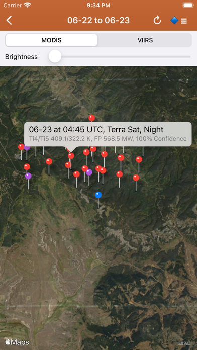
4. NASA MODIS and VIIRS satellite instruments: Thermal hotspot maps by region show wildfire activity in the past 48 hours.

5. There is a section for wildfire-related US government Twitter accounts viewable by map by approximate location or sorted into national and state sources in a table view.

6. Information is posted as soon as it becomes available from WFIGS, IRWIN, NIFC, NASA, InciWeb, CAL FIRE, CHP, NOAA, GOES/NESDIS, EPA, and NWS.

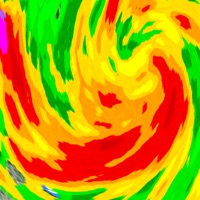
7. NESDIS GOES 16/17 satellite animation GeoColor and Fire Temperature quick links at relatively high resolution.

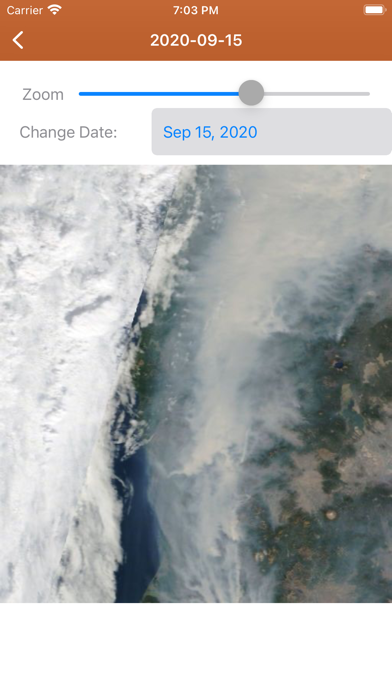
8. Premium users: View 250m resolution true color images from NASA GIBS (Global Imagery Browse Service).

9. See hotspot info including fire radiance power, brightness temperature, and confidence.

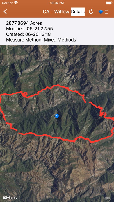
10. Active Wildfire Perimeter full data from WFIGS and IRWIN updated every 20 minutes.

11. InciWeb & CAL FIRE active fire maps: hot-link to the corresponding official incident webpage.


Pros:

  • - Thank you so much for such a great app
  • - The developer contacted me
  • - Living in a drought area of California where wildfires have happened, I check this site at least twice daily
  • - Inciweb is my go to website for all active wildfire events
  • - Along with Inciweb this app provides outlooks for the country
  • - Minimalistic app, providing the MODIS and CAL Fire and other useful maps

Download Wildfire Info Latest Version


Download and Install Wildfire Info - PC

Download for PC - server 1 -->

PC Alternatives:
Get Alternatives for Windows

MAC Download:
Download for MacOS - server 1 --> Free

Installation Requirements

PC Compactibility/Requirements for Installation

Compactible OS list:
  1. Windows 11
  2. Windows 10
  3. Windows 8.1
  4. Windows 7
  5. Windows Vista

Requirements for MacOS Installation

Intel, 64-bit processor, OS X 10.7 or later.

Compactible OS list:
  1. macOS Ventura: 13.3
  2. macOS Monterey: 12.6.4
  3. macOS Big Sur: 11.7.5
  4. macOS Catalina: 10.15
  5. macOS Mojave: 10.14
  6. macOS High Sierra: 10.13

FAQs

Wildfire Info - Is it safe to download?

Yes. The app is 100 percent (100%) safe to download and Install. Our download links are from safe sources and are frequently virus scanned to protect you

Software Reviews and Criticism


  • By CaliforniaRobin

    A great tool

    Thank you so much for such a great app - I had some trouble initially with the fire map not showing anything except the topographical map. The developer contacted me. I deleted and then downloaded the app again. It is now working perfectly.


  • By Bumihills

    Love it!

    Living in a drought area of California where wildfires have happened, I check this site at least twice daily. Thanks for making me feel more secure.


  • By crowfly80

    Inciweb at hands reach!

    Inciweb is my go to website for all active wildfire events. I do not live in an area prone to wildfires but I do pay close attention to them as I do travel quite a bit. Along with Inciweb this app provides outlooks for the country. Awesome app!


  • By devlin mccoy

    The app unfortunately does not hold record

    This app is horrible it is about whenever I try to make a fire go into a place it never updates the wildfires that makes the app bad take it off who needs an app with it I think it reminds me of Wikipedia not encyclopedia but if you can’t delete it just add more wildfires to the app this is reticules I can’t handle it anymore


  • By C2370

    Great way to stay informed of the fires within ones surroundings.

    Minimalistic app, providing the MODIS and CAL Fire and other useful maps.


Leave a review or comment


keyboard_arrow_up